Skip to content
New pricing (from Jan'26)
Tailored Pricing for Every Need
Select the perfect package tailored to your unique requirements. For larger, more complex projects, we offer custom/bespoke pricing options. Let’s talk about bringing your next vision to life.
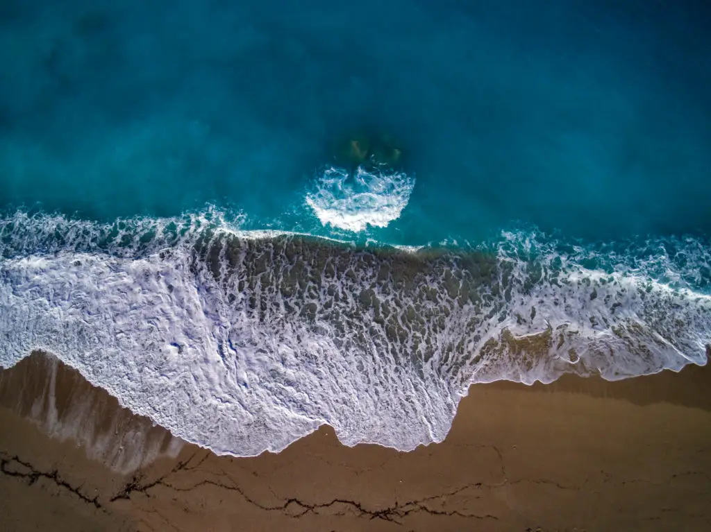
While many boast aerial mastery or ground-level creativity, few seamlessly blend both. At Blue Lid, we’re a rarity: FAA certified drone operators with a keen photographer’s eye. We aren’t just flyers; we’re seasoned visual storytellers. Additionally, our ground-level productions aren’t mere afterthoughts but a culmination of dedicated expertise. Whether it’s the expansive sky or on the ground, with us, you’re always in expert hands. Engage with a team that excels in every dimension.
(Pricing is structured by job type to keep quotes consistent. For large sites or complex access constraints, I’ll confirm scope and provide a fixed quote).
Real Estate Aerials
Aerial Photos (MLS-ready)
- Up to 16 edited aerial photos
- Web-ready and full-resolution delivery
- Additional photos: $25 each
Aerial Highlight Video
- 1 to 2 minute highlight edit (music)
- Property flyover and context shots
- Optional simple title card
Photos + Highlight Video
- Up to 16 aerial photos
- 1 to 2 minute highlight video (music)
- Delivered as a single media set
Golf Courses
Golf course pricing is typically driven by how much of the course you want featured (overview vs signature holes vs hole-by-hole), plus whether you want a promotional edit, vertical social clips, and clubhouse or amenities coverage. Footage: 4K, professionally color-graded & edited for social media or TV broadcasts.
Course Overview
Media Set
- Course and clubhouse overview coverage
- Up to 25 edited aerial photos (branding-ready)
- 1 promotional highlight video (about 60 to 90 seconds, music)
- Ideal for website, Google Business profile, and social
Signature Holes
Feature Set
- Flyovers of up to 9 signature holes
- 1 promotional highlight video (about 90 seconds)
- Up to 35 edited aerial photos (course plus amenities)
- Optional: 3 vertical clips for social (quote-based)
Hole-by-Hole Tour
(Full Course)
- Flyovers of up to 18 holes
- 18 short hole clips plus 1 promotional highlight edit
- Up to 50 edited aerial photos (course and clubhouse)
- Best for tee-time marketing, memberships, and events
- Tournament or event coverage
- Vertical social cutdowns (Reels and Shorts)
- On-camera interviews or voiceover
- Detailed graphics for hole flyovers (yardages, hazards)
- 3D Modeling / Digital Twin
- Survey Contours | elevations
Construction Progress and Documentation
Single Progress Visit
- Repeatable camera angles, master flight/mission can be set for progress tracking
- Site overview coverage (aerial)
- Dated delivery folder for easy comparison
Monthly Retainer
(2 visits)
- Two (2) scheduled visits per month
- Consistent angles each visit
- Priority scheduling
Monthly Retainer
(4 visits)
- Four (4) scheduled visits per month
- Consistent angles plus key work zones
- Optional monthly recap clip (quote-based)
Mapping and Measurement
Two mapping tiers. Both use RTK/PPK positioning and provide comprehensive deliverables. Tier 2 adds ground control and independent verification for projects requiring documented accuracy. Blue Lid is not a licensed Professional Land Surveyor (PLS). This is not a boundary survey and is not intended for legal descriptions, boundary determination, or certified as-builts.
RTK/PPK Precision Mapping
- Deliverables: Orthomosaic (GeoTIFF + viewable JPG, KMZ or web preview), Digital Surface Model (DSM), Digital Terrain Model (DTM), 1-foot topographic contours, cut/fill analysis, volumetric calculations
- Control: RTK/PPK positioning, no ground control points
- Accuracy: High relative accuracy (5-10cm) - excellent for measurements within the site
- Best for: Progress monitoring, earthwork tracking, stockpile management, volumetric calculations, internal planning and decision-making
- 0 to 50 acres: $50 per acre
- 51 to 100 acres: $45 per acre
- 100+ acres: $40 per acre
GCP-Controlled Precision Mapping
- Deliverables: Everything in RTK/PPK Precision Mapping
- Control: RTK/PPK positioning PLUS rover-measured ground control points (GCPs) used in processing
- Verification: Independent checkpoints (separate from GCPs) validate final accuracy
- Accuracy Report: Documented checkpoint results and quality metrics
- Accuracy: Verified absolute accuracy (2-5cm horizontal, 3-8cm vertical)
- Best for: Engineering design coordination, CAD/BIM integration, permit applications, compliance documentation, projects requiring documented accuracy verification
- 0 to 50 acres: $65 per acre
- 51 to 100 acres: $55 per acre
- 100+ acres: $50 per acre
- Minimums are project minimums.
- Your price is the greater of the minimum or the per-acre calculation for the mapped acreage.
- Rush processing (when schedule allows)
- Repeat monitoring flights for progress tracking (reduced rates)
- Extended analysis areas for volumetrics
- Blue Lid is not a licensed professional land surveyor (PLS)
- Customers retaining Blue Lid for 'Mapping & Measurement' will sign contract agreements. Email us for a copy.
Custom Commercial Marketing Imagery
Hourly
- On-site capture time
- Basic selects and delivery
Half Day
- Up to 4 hours on-site
- Photo and or video capture
Full Day
- Up to 8 hours on-site
- Best for multi-location or complex shoots
Ground Photography (Interiors + Exterior)
Ground Photos
(MLS-ready)
- Up to 20 HDR-edited photos
- Up to 2500 square feet included
- Additional area: $5/100 s.f.
(for larger living areas) - Main rooms, bedrooms, bathrooms, plus exterior front and rear
Ground Photos + Aerial Photos
- Includes Ground photo set
(up to 2500 square feet) - Add up to 16 edited aerial photos
- Delivered as a single media set
Ground + Aerial + Highlight Video
- Includes Ground + Aerial photo set
(up to 2500 square feet) - 1 to 2 minute highlight video
(music, additional licensing fees may apply)
FAQs on Pricing
Which mapping tier should I choose?
RTK/PPK Precision Mapping: Full deliverables including orthomosaic, DSM, DTM, contours, and volumetrics. Uses RTK/PPK positioning without ground control. Provides excellent relative accuracy (5-10cm) for measurements within the site. Best for progress monitoring, earthwork tracking, stockpile management, and internal decision-making where verified absolute positioning is not required.
GCP-Controlled Precision Mapping: Same comprehensive deliverables as Tier 1, PLUS ground control points and independent checkpoint verification. Provides verified absolute accuracy (2-5cm horizontal, 3-8cm vertical) with documented quality metrics. Best for engineering design coordination, CAD/BIM integration, permit applications, and projects requiring documented accuracy verification.
When do I actually need Tier 2 vs Tier 1?
Choose RTK/PPK Precision Mapping (Tier 1) when you need:
Progress monitoring and change detection
Stockpile volumes and earthwork quantities
Internal planning and decision-making
Site documentation and visualization
Measurements within the project site
Choose GCP-Controlled Precision Mapping (Tier 2) when you need:
Coordination with engineering design plans or CAD/BIM models
Permit applications requiring documented accuracy
Tying surveys to existing control networks
Combining data from multiple survey dates with different base positions
Third-party verification or stakeholder reporting requiring precision metrics
Contractual accuracy requirements
What is an orthomosaic map?
An orthomosaic is a stitched 2D map built from overlapping drone images captured from above. It is scale-consistent and useful for documentation, measurements, and planning.
Note: Mapping deliverables are not a boundary survey.
What deliverables do I receive?
RTK/PPK Precision Mapping includes:
Orthomosaic (GeoTIFF + viewable JPG)
Digital Surface Model (DSM) and Digital Terrain Model (DTM)
1-foot topographic contours
Volumetric calculations and cut/fill analysis
KMZ or web preview for easy viewing
GCP-Controlled Precision Mapping includes everything above PLUS:
Ground control network documentation
Independent checkpoint validation
Accuracy assessment report with documented metrics
Verified coordinates in specified datum/projection
Both tiers can also include point clouds, change detection between dates, and extended analysis areas based on project requirements.
Why does Tier 1 include volumetrics without GCPs?
Volumetric calculations depend on relative accuracy - how measurements relate to each other within the same dataset. RTK/PPK positioning provides excellent relative accuracy (5-10cm), which means distances, elevations, and volumes within the site are highly precise and reliable.
Ground control points improve absolute accuracy - how the data aligns to real-world coordinates. This matters when you need to tie to external reference systems (like design plans or property boundaries), but it doesn't significantly improve the accuracy of volume calculations within the same survey.
That's why RTK/PPK Precision Mapping delivers highly accurate volumetrics without requiring the time and cost of ground control.
What is RTK and PPK?
RTK and PPK are positioning methods that use corrections from a base station or a correction network to improve how accurately the drone camera positions are recorded.
This typically improves georeferencing and repeatability compared to GPS-only capture, which is especially helpful for measurement workflows.
What is the difference between relative accuracy and absolute accuracy?
Relative accuracy is how consistent measurements are within the site. Distances, areas, elevations, and volumes behave reliably inside the project.
Absolute accuracy is how well the data aligns to real-world coordinates. If absolute accuracy is off, the entire dataset can be shifted or tilted even if internal measurements look consistent.
What are GCPs?
Ground Control Points are physical targets placed on-site and measured with a survey rover. They are used during processing to control and correct the model to known coordinates.
What are checkpoints?
Checkpoints are independently measured points used to validate accuracy. They are not used to control the model.
In GCP-Controlled Precision Mapping, checkpoints provide independent verification separate from the control points.
What does 'verified' mean in Tier 2?
"Verified" means the accuracy is independently validated using checkpoints that were NOT used in processing the data.
Here's how it works:
1. Ground control points (GCPs) are surveyed and used to control the photogrammetric model
2. Separate checkpoint locations are also surveyed but NOT given to the processing software
3. After processing, we compare the checkpoint positions in the final model against their known surveyed positions
4. The differences are documented in an accuracy assessment report
This independent validation proves the accuracy of the final deliverables and provides quality metrics you can share with engineers, stakeholders, or regulatory agencies.
Why can't RTK/PPK alone be described as "provably centimeter" or "tenth-foot" accurate?
RTK/PPK significantly improves positioning and provides excellent results for most construction applications. However, without independent validation through checkpoints, you cannot prove the final accuracy with documented metrics.
Several factors affect the final result:
Site conditions (terrain, obstructions, satellite visibility)
RTK/PPK signal quality during flight
Photogrammetric processing and bundle adjustment
Base station position accuracy
RTK/PPK Precision Mapping delivers highly accurate data that's excellent for progress monitoring, volumetrics, and internal decision-making. The limitation is that the accuracy is not independently verified with documented metrics.
If you need to prove your accuracy to engineers, stakeholders, or regulators, that's when you need GCP-Controlled Precision Mapping with independent checkpoint validation.
What does "tenth-foot" mean?
"Tenth-foot" usually refers to 0.1 foot, about 1.2 inches. People often use it as shorthand for tight accuracy expectations.
Without GCP control and independent checkpoints, it is not appropriate to claim that standard.
Can you guarantee 2 centimeter accuracy?
Accuracy depends on site conditions, capture settings, positioning method, and whether control and validation are used.
RTK/PPK Precision Mapping (Tier 1) provides 5-10cm relative accuracy, which is excellent for volumetric calculations and progress monitoring but is not independently verified.
GCP-Controlled Precision Mapping (Tier 2) provides verified absolute accuracy typically in the 2-5cm horizontal and 3-8cm vertical range, documented through independent checkpoint validation.
If you have a specific accuracy requirement (such as "2cm horizontal accuracy"), mention it up front so we can recommend the appropriate tier and document the results properly.
What does the Tier 2 accuracy report include?
GCP-Controlled Precision Mapping includes a short summary of the control and validation approach. This typically covers point counts, checkpoint results, and a basic QC overview tied to the project.
This supports confidence in reporting and repeatability. It is not a substitute for licensed survey deliverables.
How do stockpile volumes and cut and fill pricing work?
Volumetrics and cut/fill analysis are included in both mapping tiers at no additional charge. The base per-acre pricing covers standard volumetric calculations within the mapped area.
Extended analysis areas beyond the primary mapped area, or complex multi-comparison analyses across multiple survey dates, may be quoted separately based on scope.
What is Smart Oblique capture and when do I need it?
Smart Oblique capture collects nadir images plus multiple oblique angles during a single mission. It is most useful for complex geometry.
Examples include stockpiles, steep slopes, berms, retaining walls, quarry faces, and other irregular shapes.
Does Smart Oblique replace GCPs or checkpoints?
No. Smart Oblique improves reconstruction completeness. GCPs and checkpoints are about control and validation.
If your project requires documented accuracy verification, GCPs and checkpoints are still the correct tools.
Do you always need crosshatch or multiple flight patterns?
Not always. Flight planning depends on the deliverables and the site.
For many 2D mapping jobs, a single nadir plan is sufficient. For complex geometry and 3D reconstruction, adding obliques can reduce the need for separate oblique passes, depending on conditions and the required output.
What file formats do you deliver?
Common deliverables include:
Orthomosaic: GeoTIFF (plus a viewable JPG)
Viewing and overlays: KMZ and/or a web preview
Tier 2 outputs: surfaces, contours, and analysis exports can be delivered in GIS and CAD friendly formats based on your workflow
If you have a preferred format or software workflow, call it out in the request so the deliverables match your needs.
Do I need mapping or just aerial photos?
If you need context, marketing visuals, and a clear overview, aerial photos are usually enough.
If you need measurements, areas, repeatable progress comparisons, volumes, or cut and fill, you want mapping.
What affects price the most?
The main drivers are total acreage, required tier (RTK/PPK Precision vs GCP-Controlled Precision Mapping), site access, and analysis outputs (volumes, cut and fill, comparisons).
Turnaround time and travel can also affect pricing.
What is your typical turnaround time?
Typical turnaround is 3 to 5 business days depending on scope.
Rush delivery may be available when schedule allows and can include a rush fee.
Travel, mobilization, and site access
Travel is quoted up front based on location and site access.
Sites requiring escorts, special scheduling, or extended on-foot access for control placement may include a mobilization or access fee.
How do vegetation and ground conditions affect deliverables like a DTM?
Photogrammetry models what the camera can see. Dense vegetation can block the ground surface, which limits ground extraction for products like a DTM.
If vegetation is heavy, the DTM may be limited or may require an adjusted approach based on the project goal.
What happens if weather delays the flight?
If conditions are not suitable for safe flying or good data quality, the flight is rescheduled.
If repeated attempts are required due to site availability or weather windows, a remobilization fee or refund credits (for example, missed flights due to weather) may apply.
What do you need from me before you arrive?
I need the site address, a point of contact, access instructions, areas of focus, and any known restrictions.
For GCP-controlled work, I also need confirmation that GCP placement is allowed and that the site is safe and accessible for on-foot placement.
Are you a licensed surveyor? What is this data used for?
No. Blue Lid is not a licensed Professional Land Surveyor (PLS).
This service is intended for mapping, volumetric estimation, progress monitoring, and project planning. It is not intended for legal descriptions, boundary determination, or certified as-builts.
Usage and licensing
Usage is confirmed in the quote. Real estate deliverables are typically intended for listing marketing. Commercial projects often involve broader ongoing marketing use.
If you have a specific internal or external use case, include it in the request so scope and expectations are clear.
ask about custom pricing
Custom Solutions, Competitive Prices
While our standard packages cater to many, intricate projects may require a more tailored approach. Rest assured, we collaborate closely to craft a package that’s both competitively priced and within your budget.

How We Work
Our Booking Process


Select Your Pricing Plan
Base plans and custom quotes are available

Request & Confirm
Call or email to confirm your project

Booking Payment (Online)
Booking through Bookly or simply call or email us

Enjoy Your Service
We ensure we will meet or exceed your expectations


Need Aerial Imagery?
Got questions before Booking? Or book a FREE 15 min. Consult